Figures
Application and Graphics
Use the quick links to find materials on this page.
Click on any image to open up the document in a new web browser window to look at the material in greater detail.
Quick Links
-
Grant Application Narrative
-
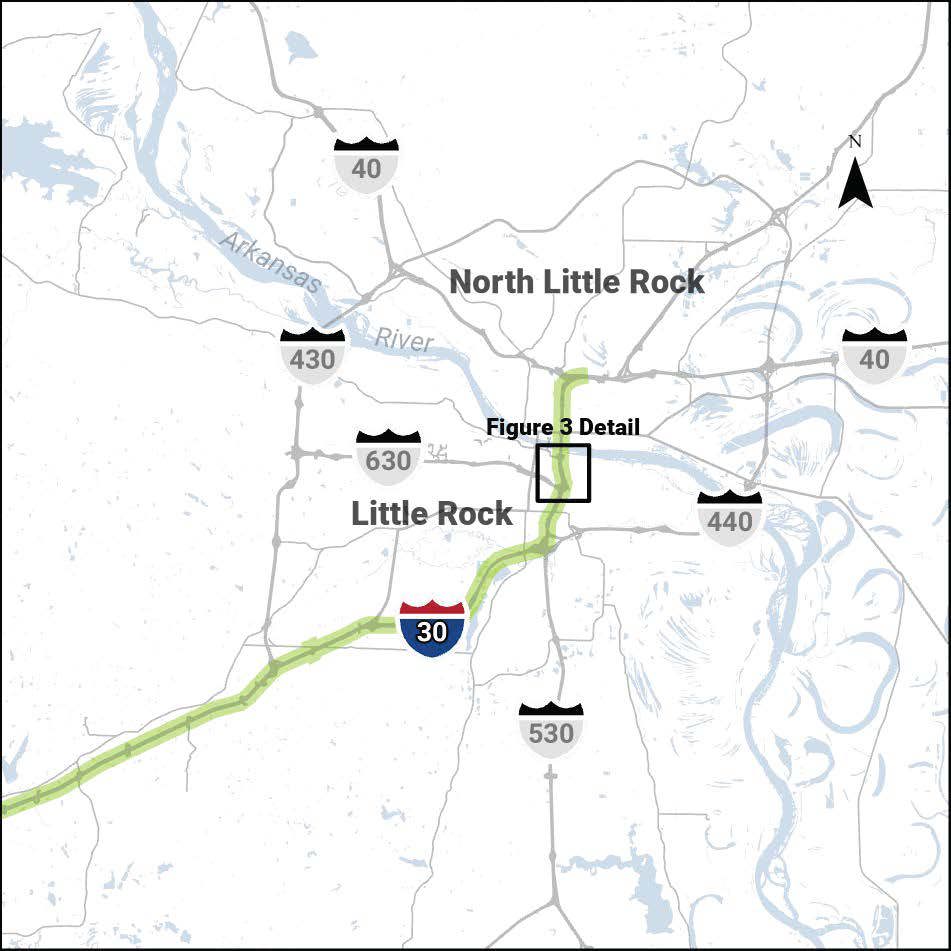
Figure 1: Highway Network in Little Rock Area
-
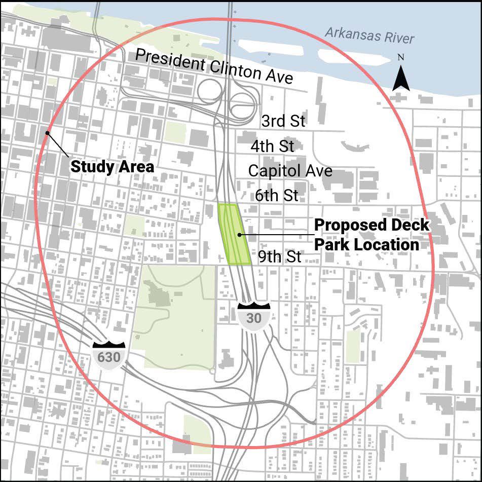
Figure 2: I-30 in Downtown Little Rock and Proposed Deck Park Location
-
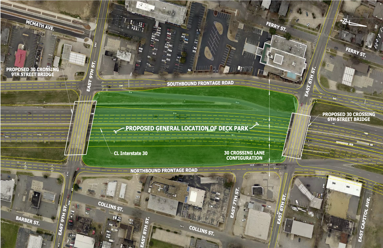
Figure 3: 30 Crossing I-30 Plan View and Typical Section
-
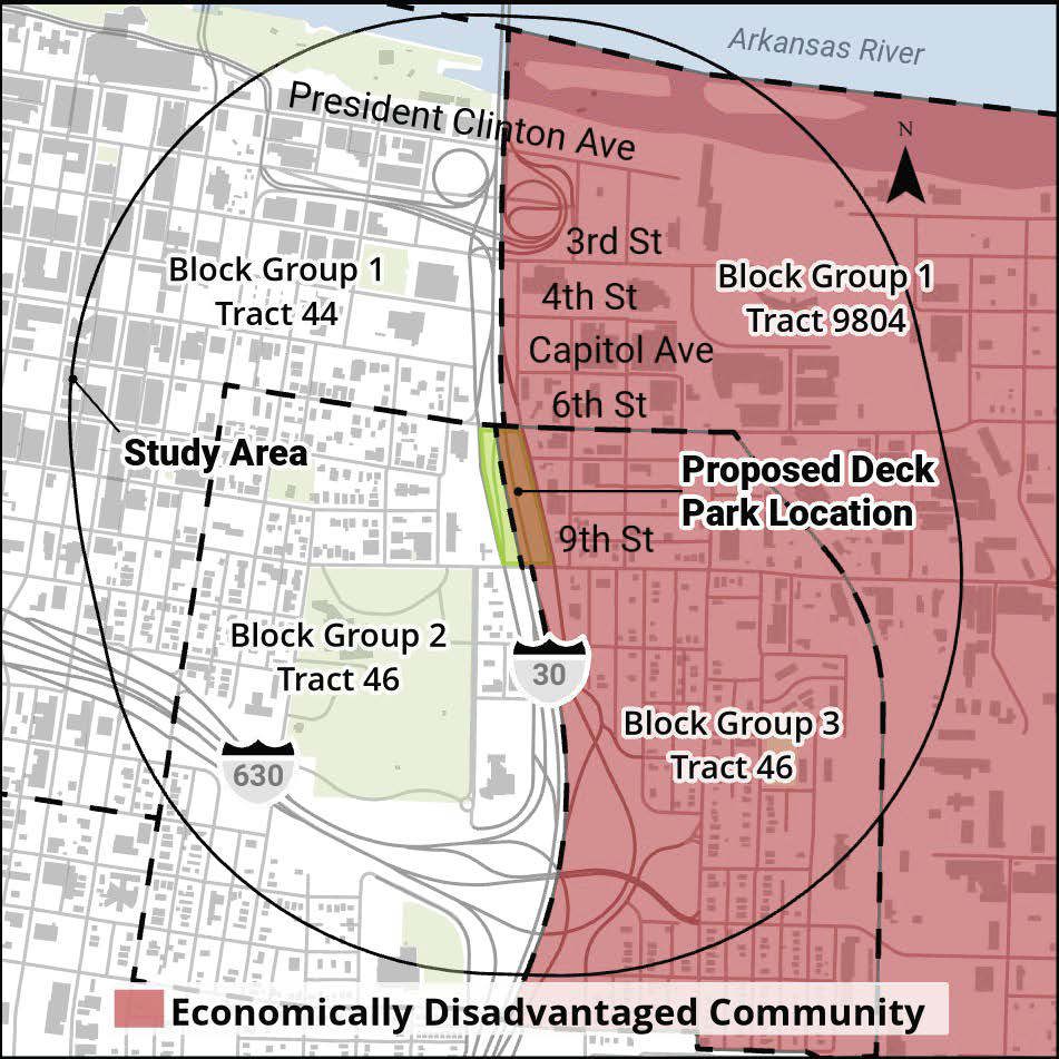
Figure 4: EJScreen Socioeconomic Indicator within Project Study Area or Project Location
-
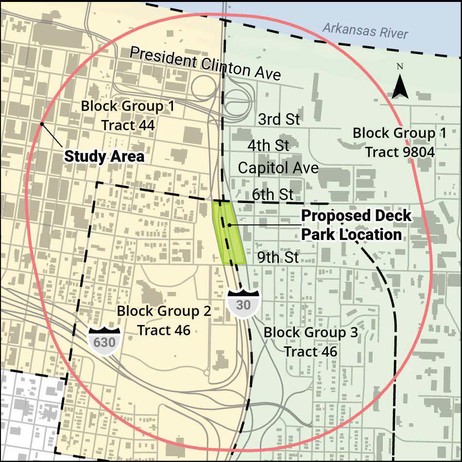
Figure 5: Block Groups within Project Location
-
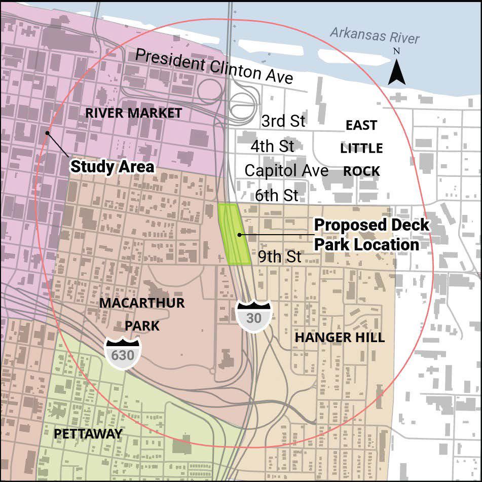
Figure 6: I-30 Deck Park Study Area and Surrounding Neighborhoods
-
Figure 7: Pre and Post Construction of I-30 within the Study Area
Plan View
🔗
Typical Section

🔗